|
Return to Ohio ALHN
Return to Index
THE QUESTION OF THE BOUNDARY OF THE STATE.
 THE question of boundary, though not expressly referred to the convention (The Constitutional Convention of 18o2) was one of greater importance than would appear at first view. It is generally known to those who have consulted the maps of the western country extant at the time the Ordinance of 1787 was passed, that Lake Michigan was -represented as being very far ncrth of the position which it has since been ascertained to occupy. On a map in the Department of State (at Washington) which was before the committee of Congress who formed the ordinance for the government of the Territory, the southern boundary of that lake was laid down as being near the forty-second degree of north latitude, and there was a pencil line passing through the southern bend -of the lake, to the Canada line, which intersected the strait between the River Raisin and the town of Detroit. The line was manifestly intended by the committee, and by Congress, to be the northern boundary of this .state; and that map, and the line marked on it, should have been taken as conclusive evidence of the boundary, without reference to the actual position of the southern extreme of the lake.
When the Convention was in session in 1802, it was the prevailing opinion that the old maps were correct ; and that the line, as defined in the ordinance, would terminate at some point on the strait far above the Maumee Bay; but, while that subject was under discussion, a man who had hunted many years on Lake Michigan and was well acquainted with its position, happened to be in Chillicothe, and in conversation with some of the members, mentioned to them that the lake extended much farther south than was generally supposed ; and that a map he had seen placed its southern bend many miles north of its true position. His statement produced some apprehension and excitement on the subject, and induced the convention to change the line prescribed in the act of Congress, so far as to provide, that if it should be found to strike Lake Erie below the Maumee River, as the hunter informed them it would, then the boundary of the state should be a line drawn from the point where the prescribed line intersected the west boundary of the state, direct to the most northern cape of the Maumee Bay. That provision saved to the State of Ohio the valuable ports and harbors on the Maumee River and bay,which were the prize contended for in the Michigan war of Governor Lucas." Yet some of the members (of the Convention) hesitated in making the provision, lest it might cause delay ; but fortunately it was adopted and its object is now secure." (Burnett's "Notes on the Northwestern Territory," 1847, P. 36o.) (See also the language of the Acts -of Congress, 1800, 1802-1812, quoted in Part I of this publication.
EDITOR.
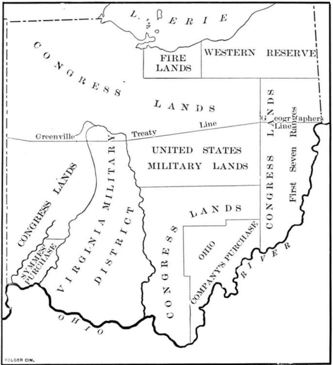
MAP OF OHIO SHOWING FINAL BOUNDARY OF 1802

Background Design
by

Barbara's Bordered Backgrounds
|